
|
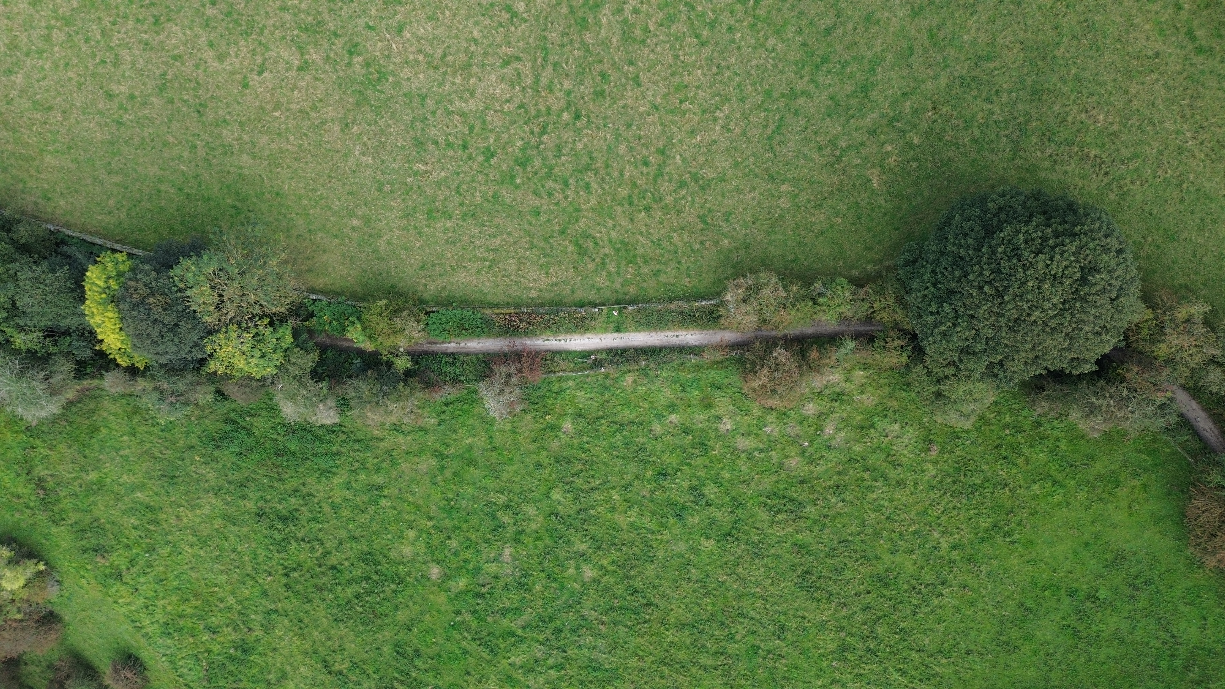
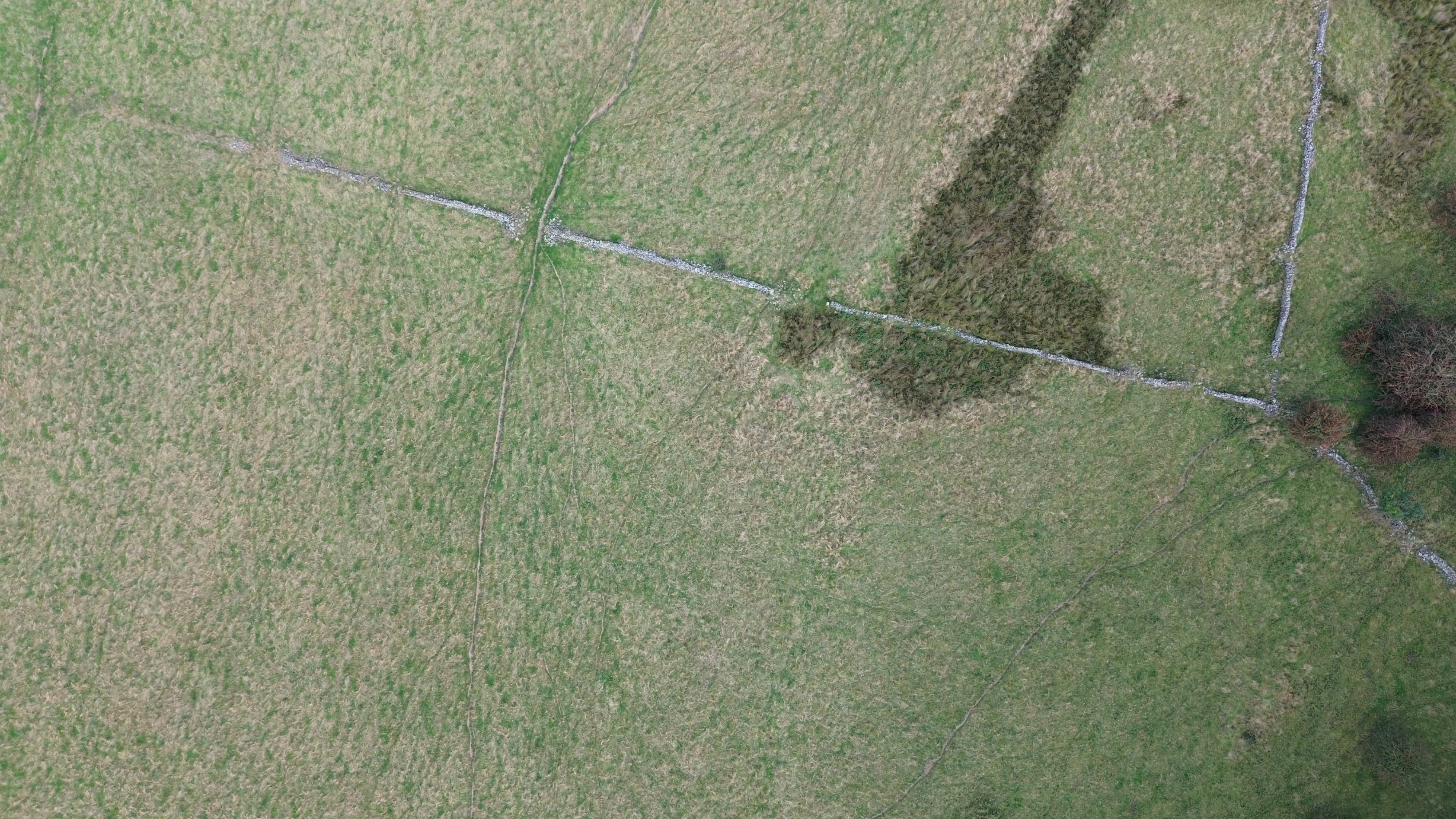
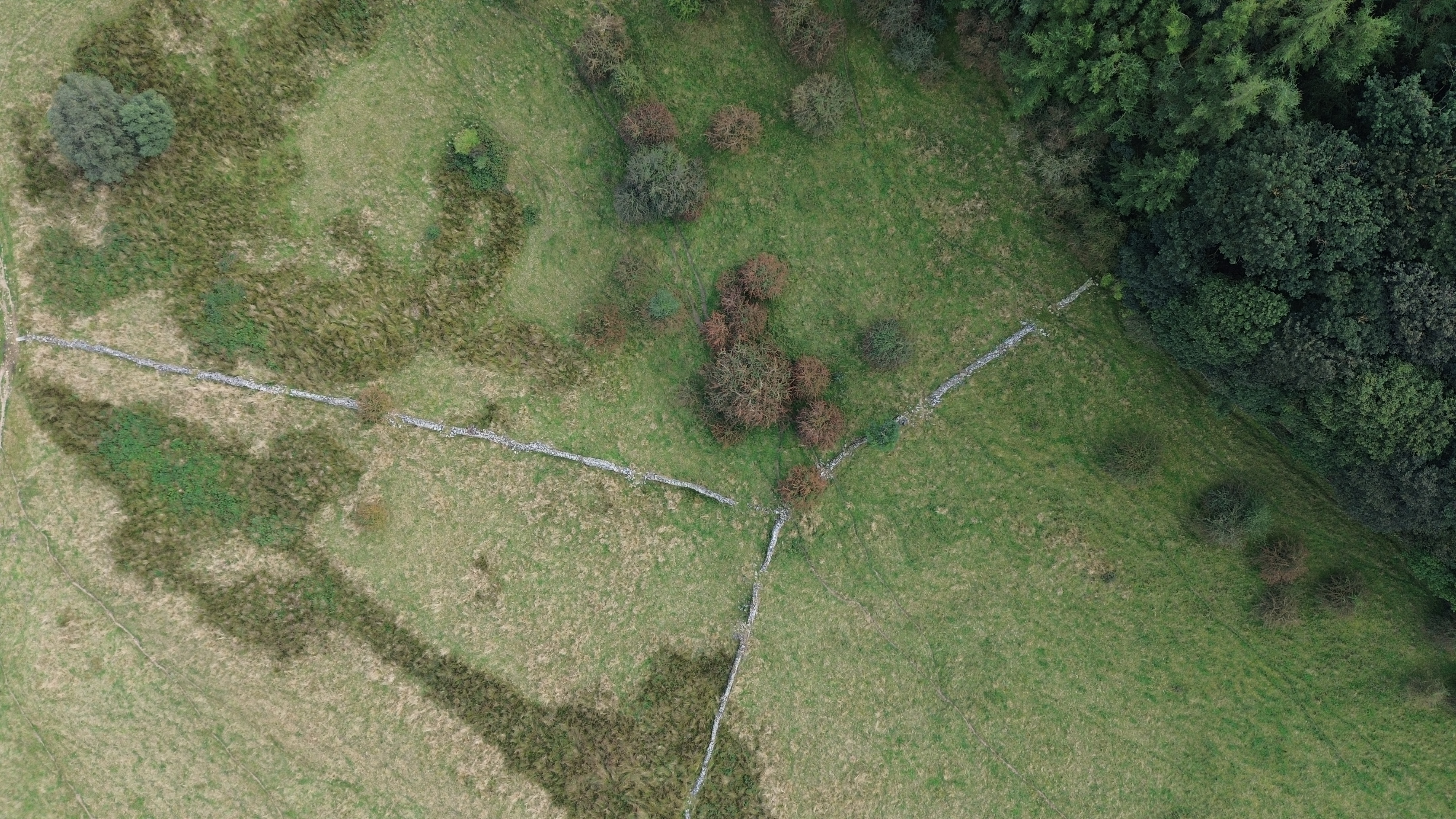
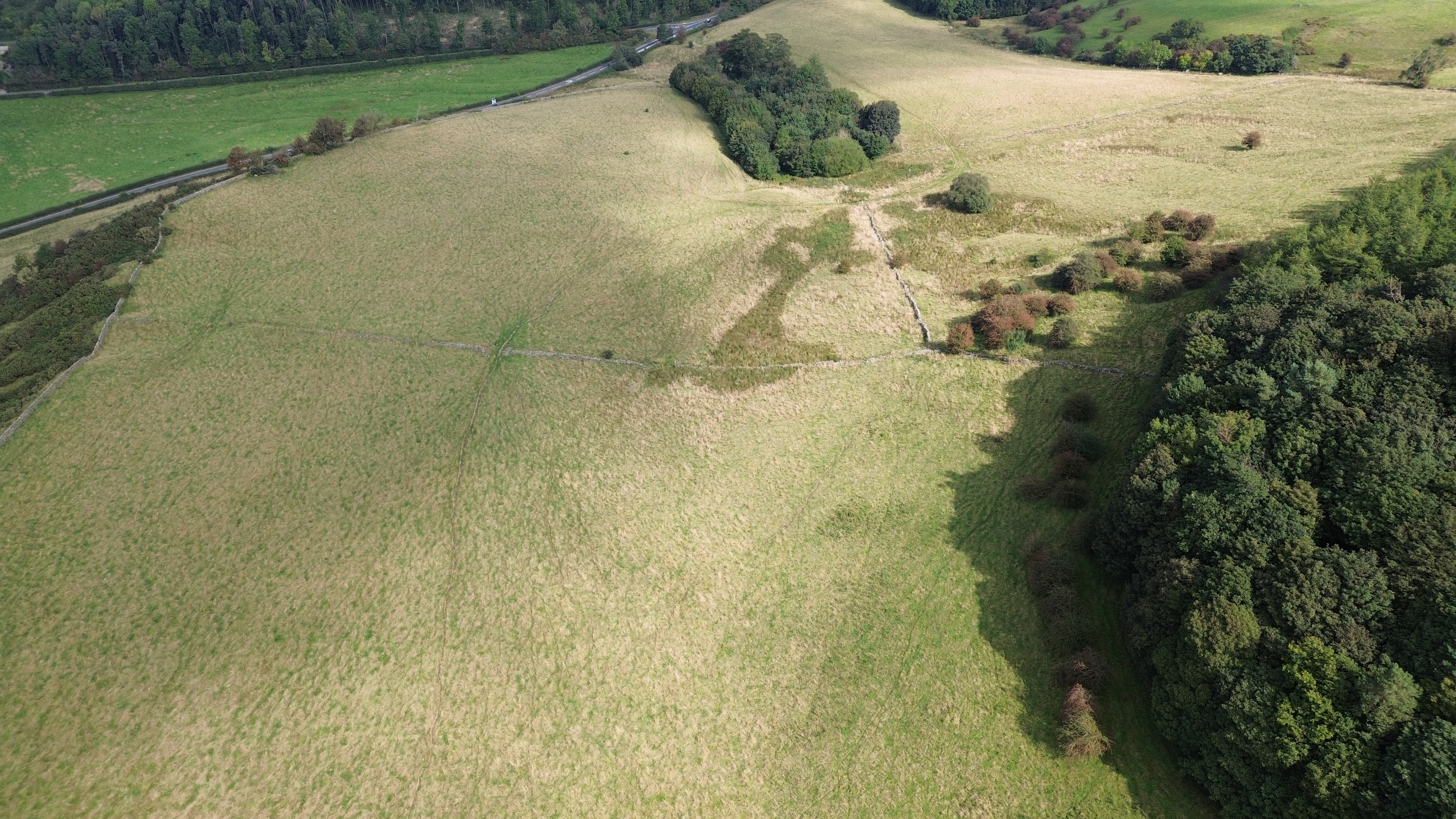
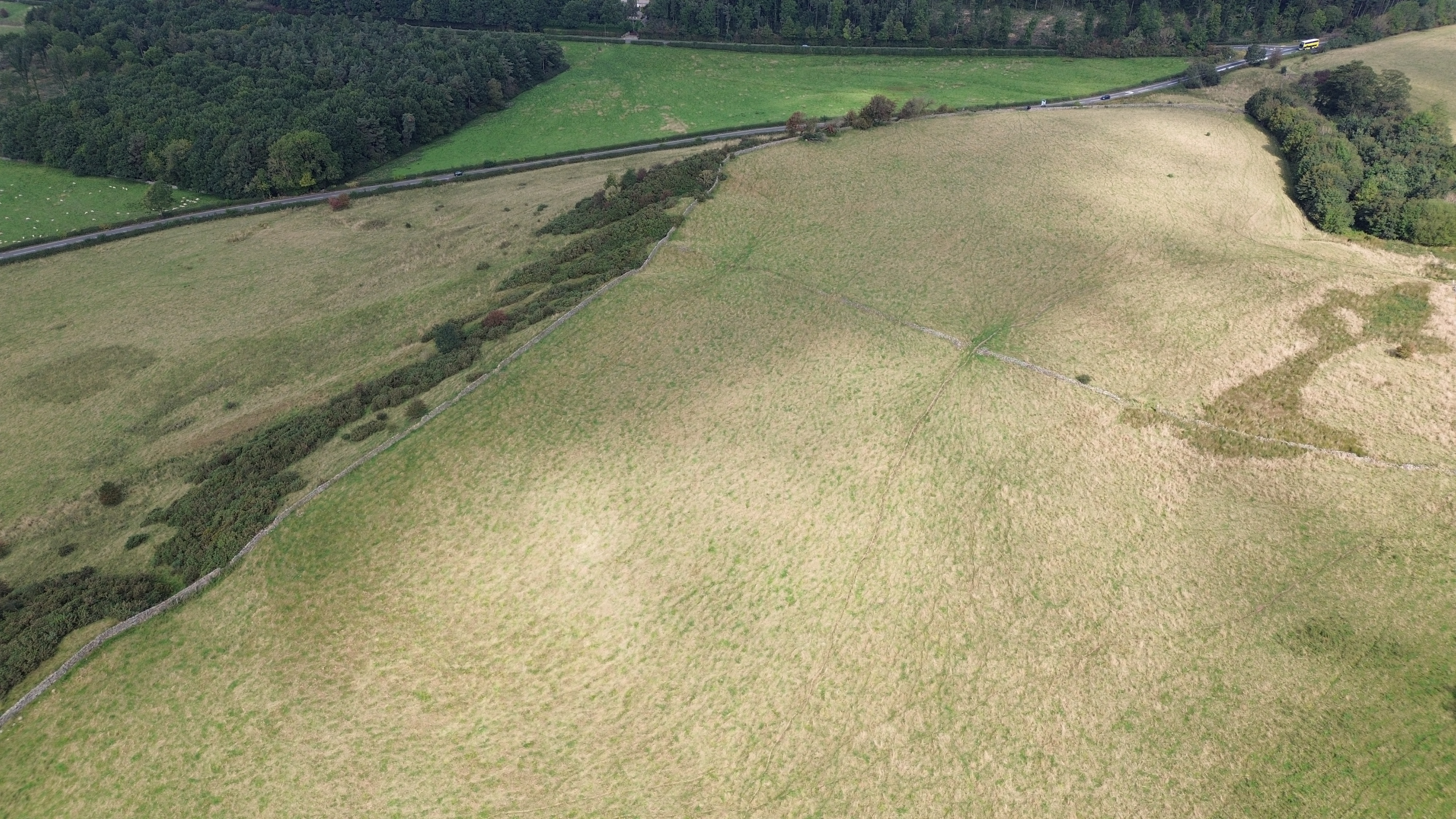
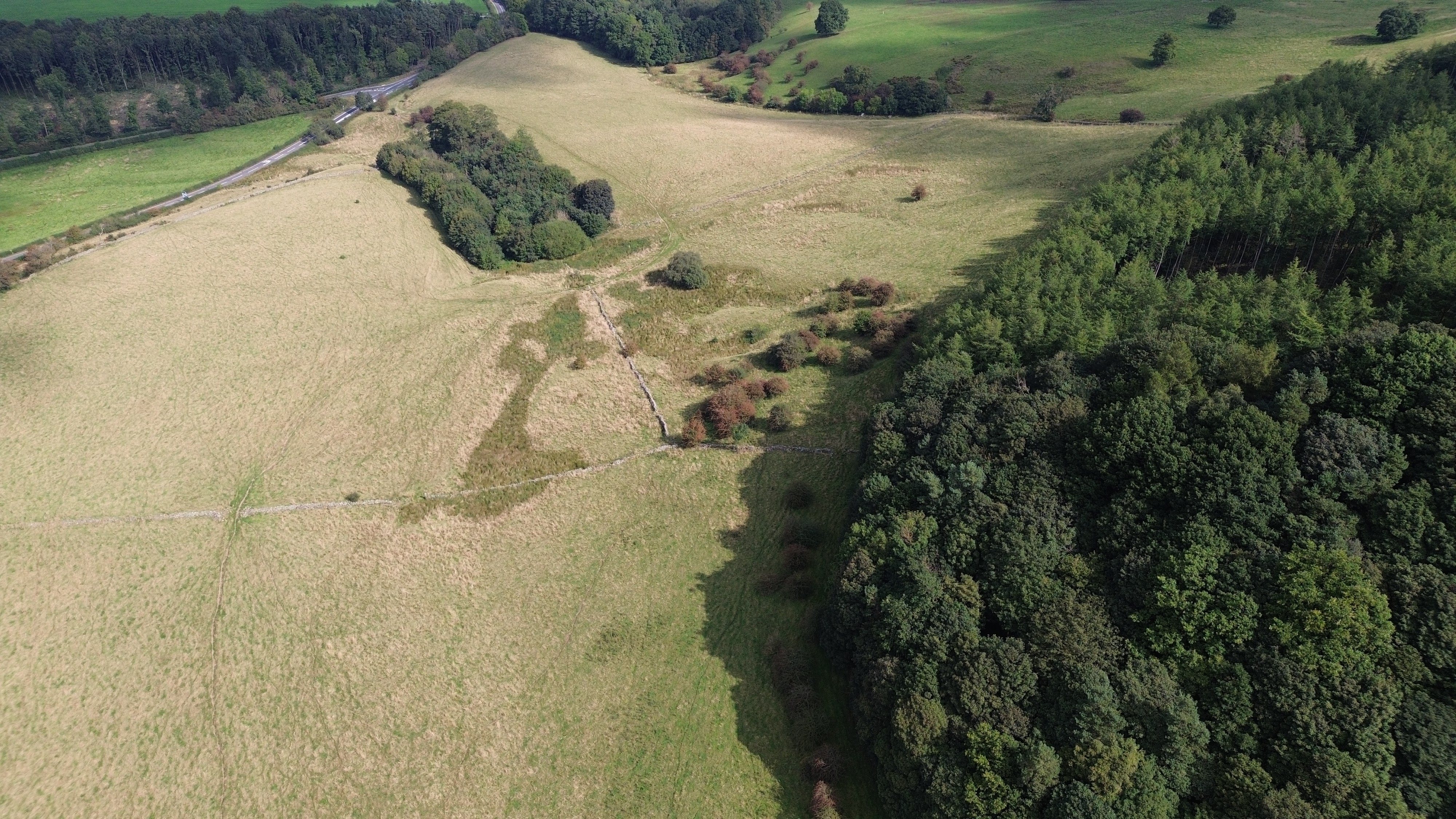
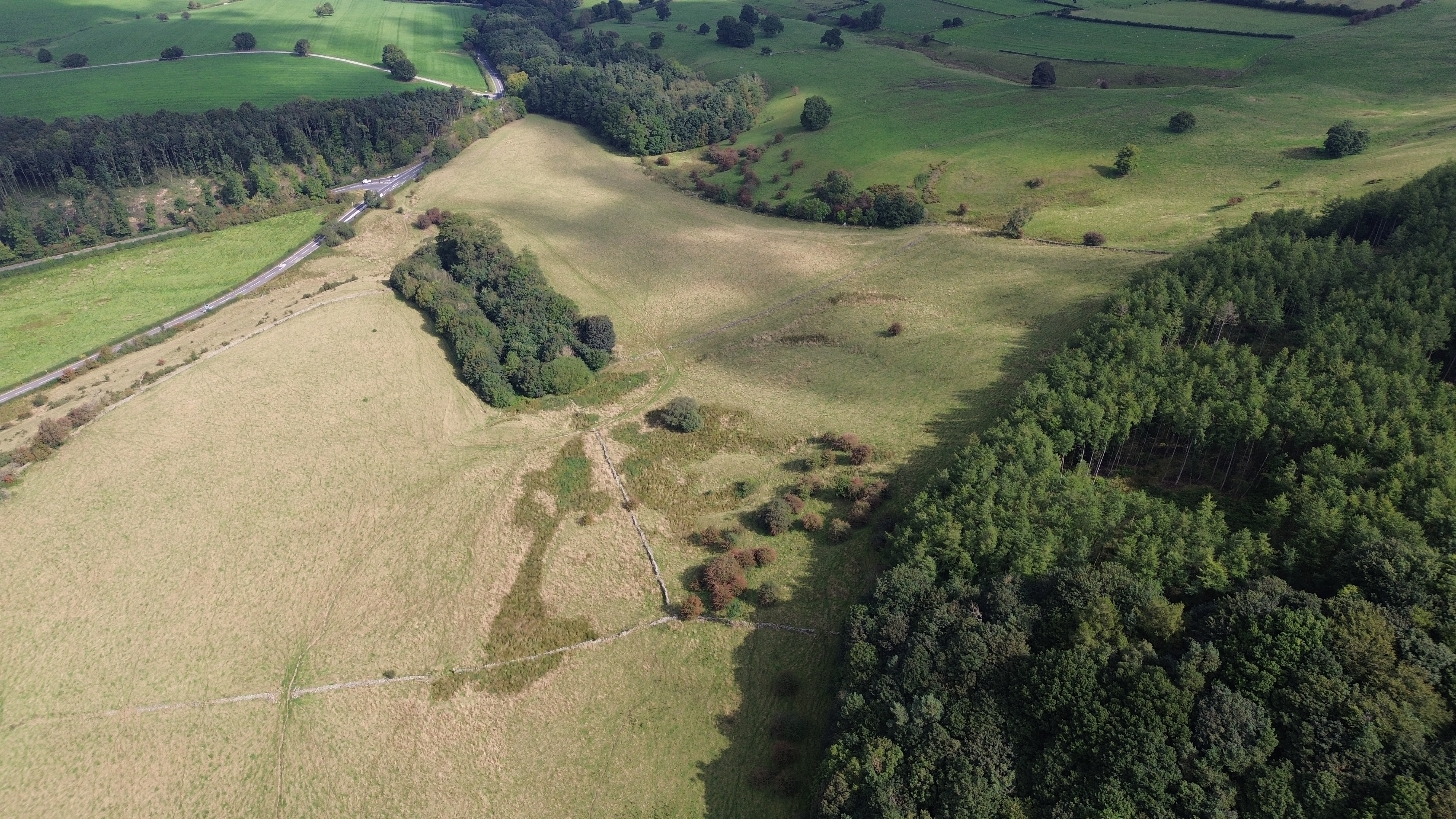
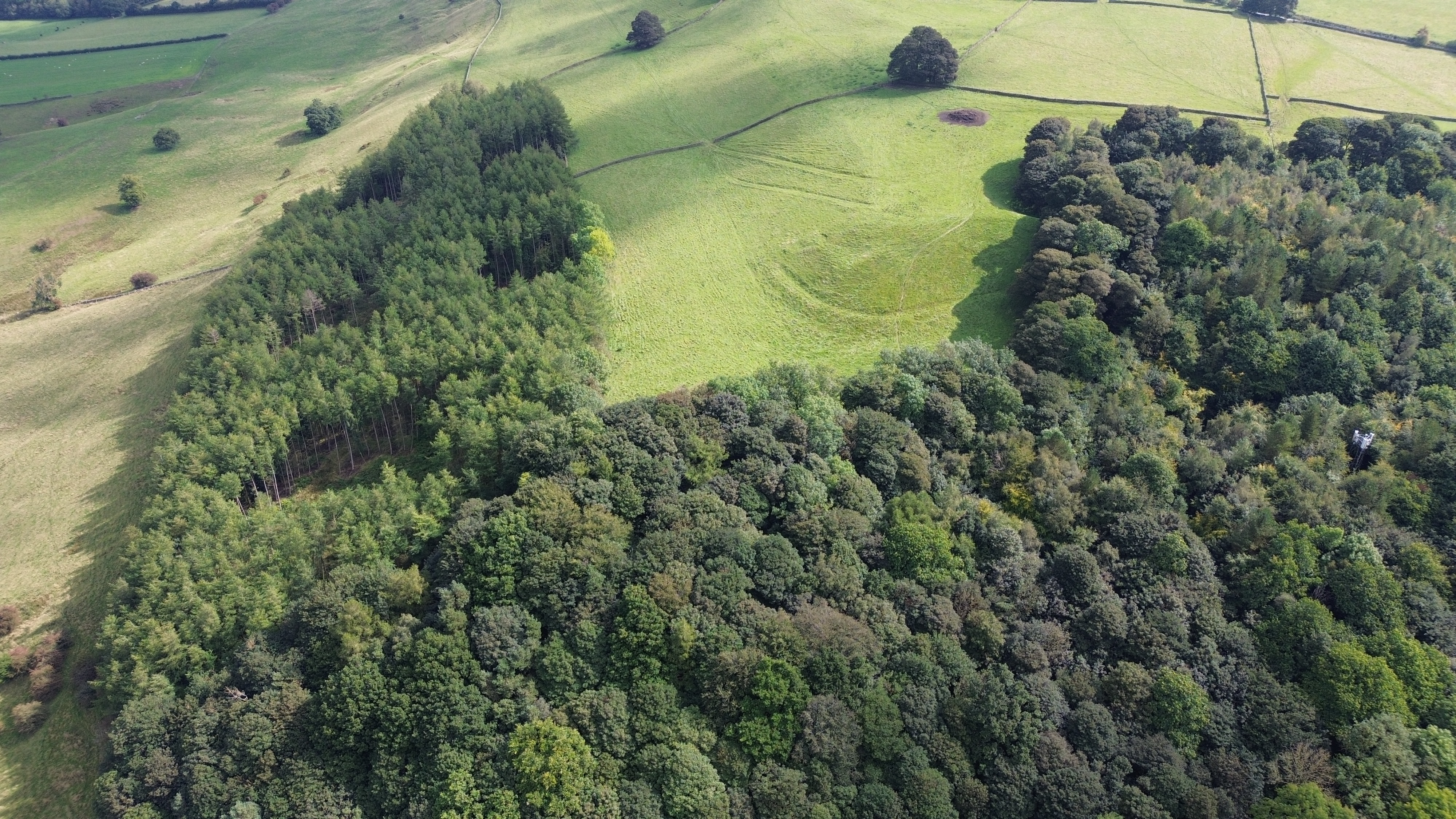
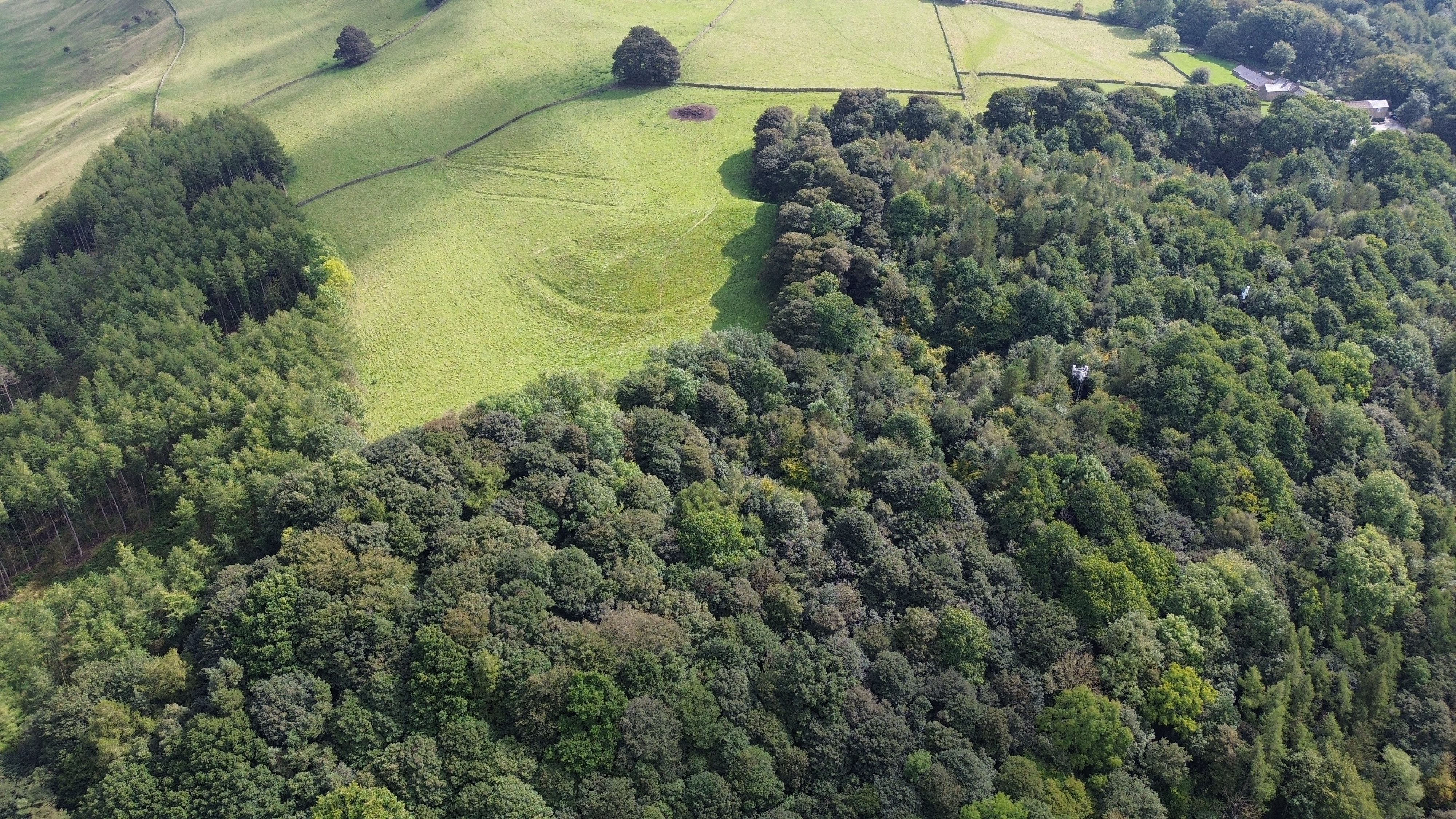
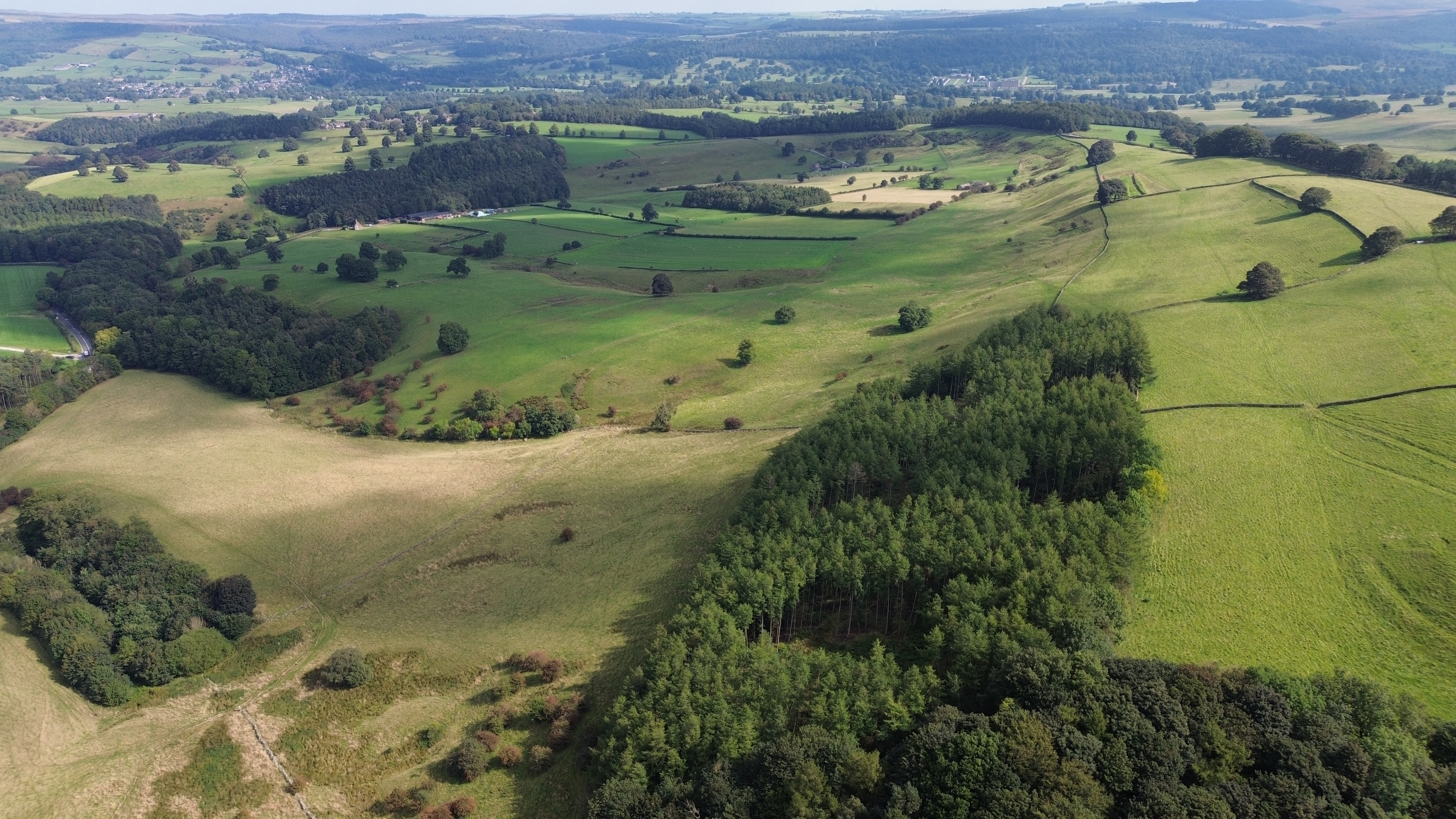
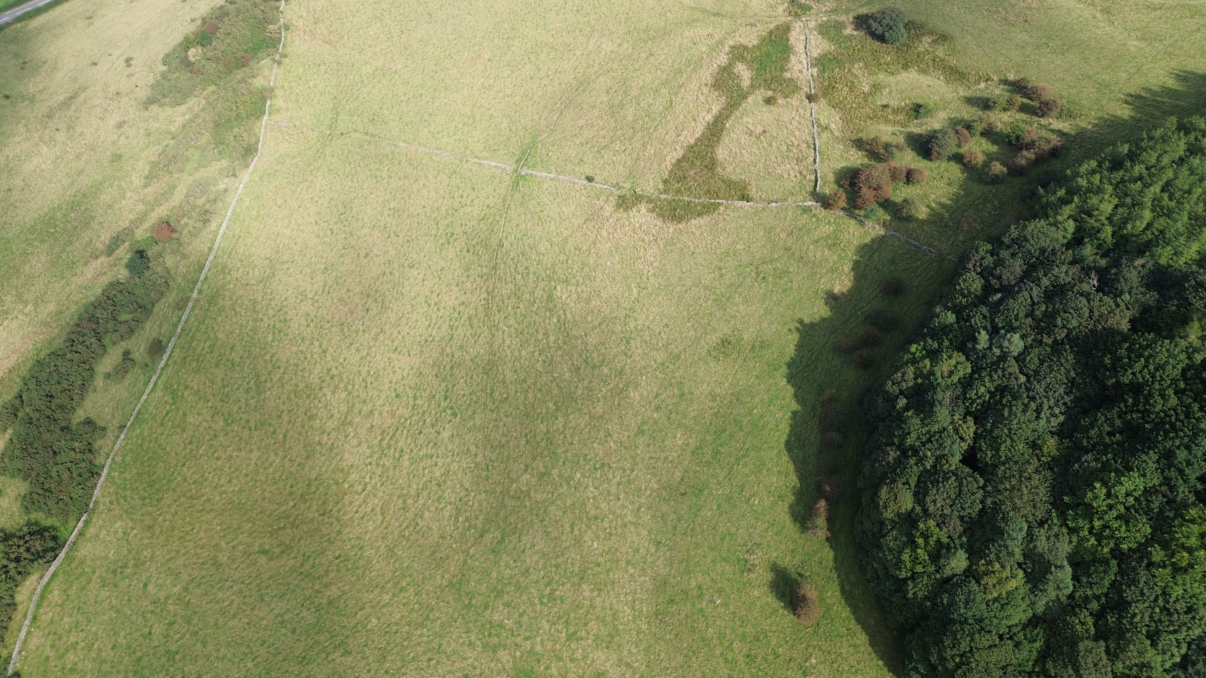
Our first aerial area of archaeological interest is in Bakewell. It is a roughly 'hammer' shaped area around the outskirts of the historic town. Aerial Archaeology of THE PEAK DISTRICTIn partnership with The Corrigan Social FundSatellite & Geomapping StudyBAKEWELL2023 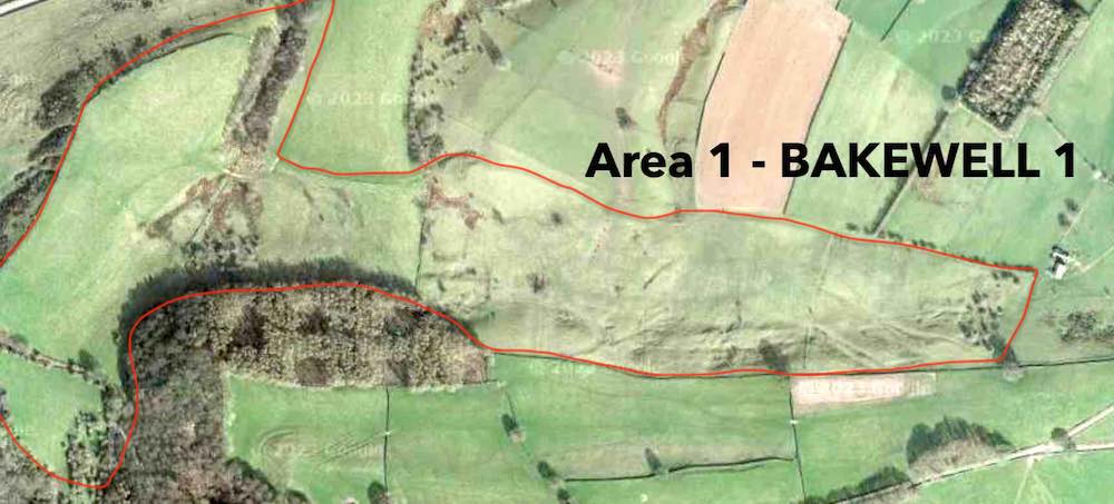 PLATE 1 - AREA 1, BAKEWELL 1 1. The Peak DistrictThe Peak District is an ancient place. The National Park has remained largely untouched and mostly preserved for hundreds of years. The Peak District is comprised of some large and many small villages peppered around Derbyshire. These small centres have moved over centuries, back and forth, oscillating in location. in fact, differing economic needs have moved centres of production and habitation for over tens if not hundreds of thousands of years all over Derbyshire. 2. Aerial ArchaeologyOur first aerial area of archaeological interest is Bakewell and the image above is the area of interest. All these pictures were taken in summer. It was spotted with Google Maps and it is a roughly 'hammer' shaped area around the outskirts of the historic Derbyshire town. We can see that the 'hammer' shape of area 1 is on the left of PLATE 1. The handle of the hammer is bounded by the wedge shaped boundary tapering down and to the right in PLATE 1. The 'hammer' is composed of four main segments. The first is the head to the far left of the image, the second is a smaller lobe above the wooded copse. The next lobe from the left is the largest and contains the most lumps and bumps. The land within the 3rd lobe of the hammer is filled with these bumps and from the ground it is obvious that something was going on for a long time in this area. The last segment of this hammer shape is the far right most segment. The first thing we can see from PLATE 1 is that if you look at the boundary lines within it, we can see that they have been essentially disregarded. Clearly this area has been isolated and protected from visitors for some time. Furthermore, we can see that the boundary lines that are within the whole hammer section do not neatly match up with those that surround it and lead away from it. This whole area is in fact a little part of an older landscape, a fossil landscape. This fossil landscape can still be partly made out. For example, if we look at that far right most segment, we can see that it has a left-most boundary running up it that separates that section from the largest section. If we follow the line up from the bottom of the image we can see that it faintly continues on up and off the image. It actually leads off to the Chatsworth estate. We can see that everything above the boundary of the hammer handle has been cultivated. 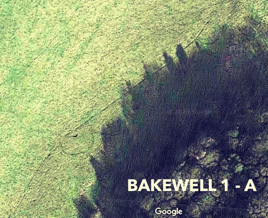 PLATE 2, BAKEWELL 1 - A 3. Field MarkingsOur next image is PLATE 2 above, which is a part of the hammers head. There is a nice clear line that dissects PLATE 2 nearly on the diagonal. Between it are two circles themselves dissected by the line. For scale, a person is about the size of the prominent hole seen in the middle of the lower circle. The land to the right of the line rises sharply and is the hill top. Is this a hill-fort boundary with two wooden towers? Further investigation could answer this question. 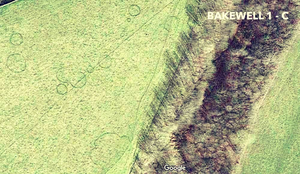 PLATE 3, BAKEWELL 1 - C In PLATE 3 we can see the back of the hammer shape, here the field markings are most prominant. Running up the middle of the image appears to be a boundary line, athough it could be a sheep track. At the bottom of the image there appears to be a crecent flanked by two lobes up against the possible boundary. Further up the image seems to be a circle that is intersected by the boundary. In the field itself we count at least 10 circles. Could these be round houses and is the crescent structure a building? 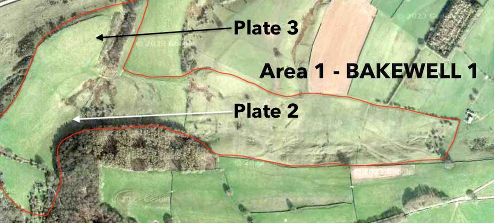 PLATE 4 PLATE 4 shows the location of PLATES 2 and 3. As you can see, both images are located within the head of the hammer. The darker land to the far left of PLATE 4 drops away down a hill, and all of the land in the hammers head is a plateaux. This can be seen more clearly in PLATES 5 and 6 below. PLATES 5 and 6 show us the intersection between PLATES 2 and 3, as we can see, this is a marshy area containing two of the few field walls still intact as can be seen in PLATE 7. 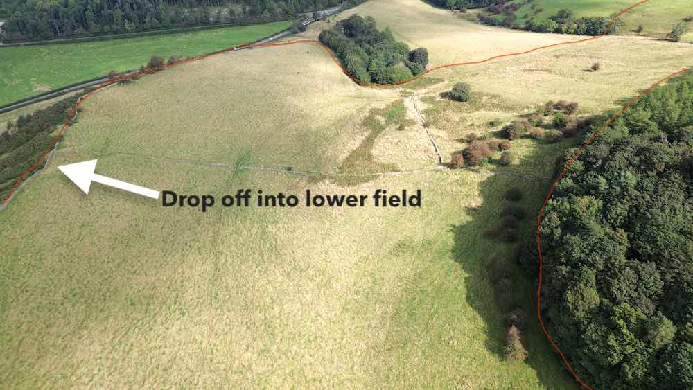 PLATE 5 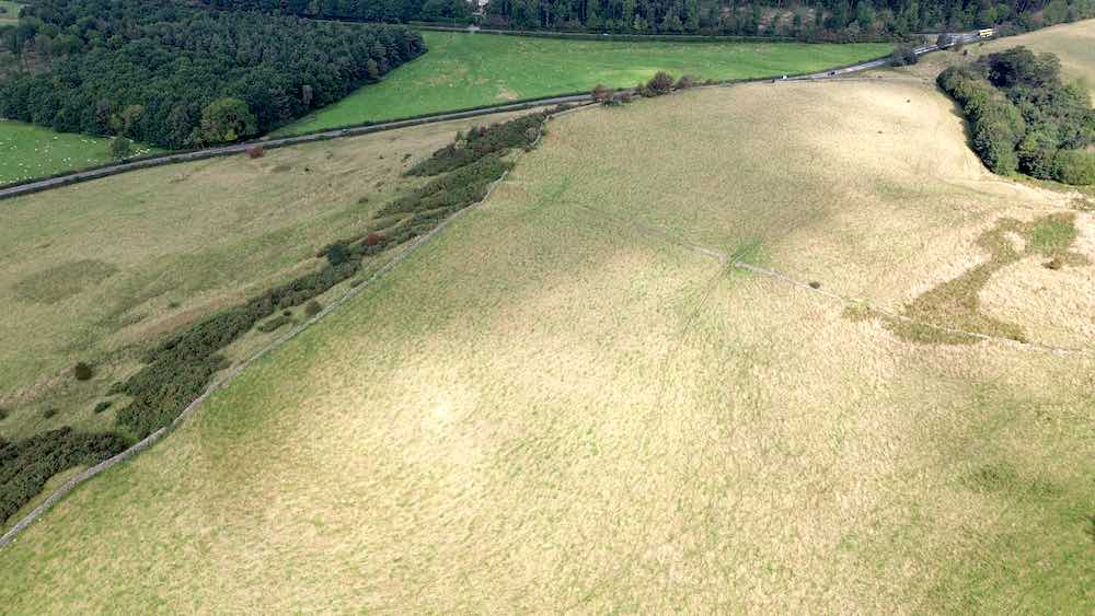 PLATE 6 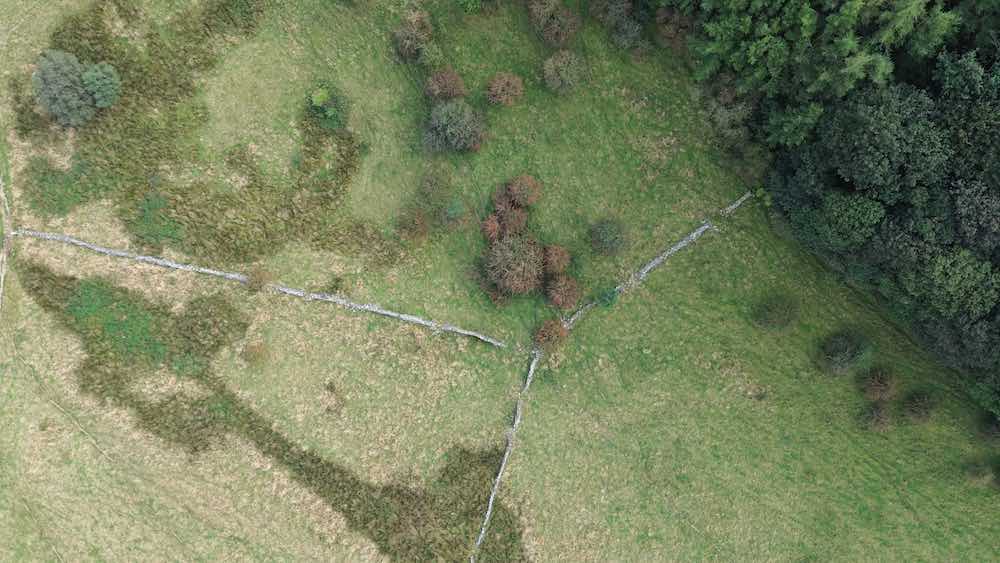 PLATE 7  PLATE 8 PLATE 8 shows the middle section of the 'handle' of the hammer shape. This whole section rises and is a hill side. It is located in the middle of PLATE 1. As we can see there are many lines and shapes within this image. Notice the boxed section to the right of the trees on the left of the image, we can clearly see nearly horizontal lines in what look like a planting area of some kind. To the far left, just above the trees, are two large platforms cut into the hill side, about the right size for buildings. PLATE 8 and 9 also shows evidence of a dogleg shaped road that leads up out of the field. This channel has other roots too which cross an earlier boundary of some kind before joining the main branch out. Why have we termed this a road? Well, look at PLATES 10 and 11. Here we can clearly see that these large lines match up with lines in the adjacent field. Whatever this structure is, it clearly continues into this field and then from this angle appears to end in something much bigger. 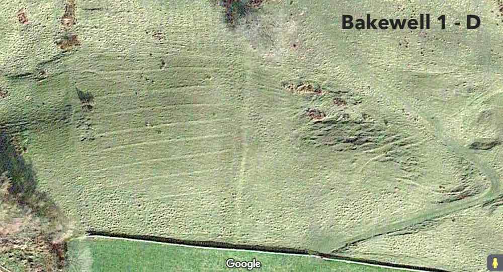 PLATE 9 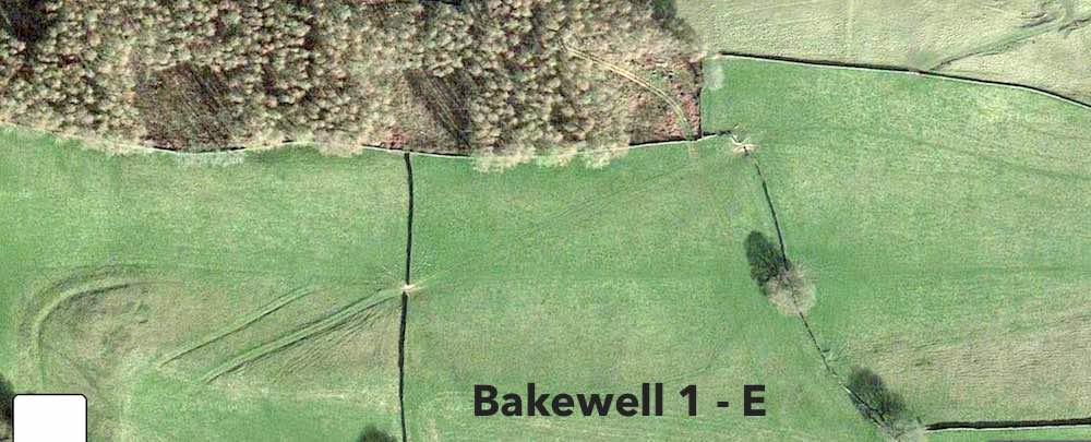 PLATE 10 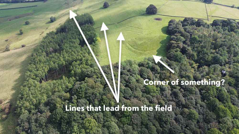 PLATE 11 Area 1 is associated with a woodland area. In PLATE 11 we see the top most part of this woodland area. Within the woodland area are stone built bridges, carved heads, evidence of extensive mining, and ramps up and down the hillside. See the attached video to see the extent of the woodland. You will find HI-RES images of area 1 below, these images are free to use so please use responsibly. They are unprocessed and make great desktops. What is going on in this area? please leave your comments below. This is clearly an area of archaeological interest and possibly national heritage. There are other know ancient structures in this area, are they connected? Would knowing the answer to this question help us understand the history of Bakewell more clearly? It appears likely. Watch out for more undiscovered aerial archaeology of the Peak District in this BLOG series coming soon! 4. Images
Note. Images 7, 14 & 15 contain private houses and have been removed from the dataset. The Corrigan Social FundWhat Do CSF Do?The CSF or Corrigan Social Fund is based in Derbyshire and provides high quality satellite, geo-mapping, LIDAR, photographic and multispectral analysis for agriculture, coupled with detailed archaeological data. This service is delivered in a three day period and can be paid for using social grant funding. PurposeThe resultant data can be used for example, to 3D map, record and thus preserve vulnerable or at risk sites. To photograph archaeological sites of interest. To build a map of roofing before it is physically examined. To carry out multispectral mapping of farmland. To inform trenches for small investigative digs. To find lost hikers and stranded people.
2 Comments
John Lucas
9/15/2023 03:17:19 pm
Very interesting images and text.
Peak Soap
9/15/2023 11:05:38 pm
Thank-you John, these are great suggestions and we would love to feature lead sites. Please do leave your suggestions for sites so we can follow up on this. 😀 Your comment will be posted after it is approved.
Leave a Reply. |
|||||||||||||||||||||||||||
Peak Soap
The Original Bakewell Soap Co.
Contact : [email protected] | Copyright 2023 © P e a k S o a p Ltd.
P e a k S o a p™ Ltd. is registered in the United Kingdom | Office : Diamond House, Water Street, Bakewell, DE45 1EW | Company No. 11684582
P e a k S o a p™ Ltd. is registered in the United Kingdom | Office : Diamond House, Water Street, Bakewell, DE45 1EW | Company No. 11684582