|
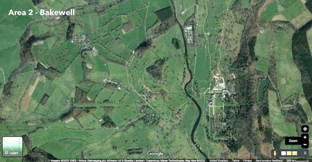
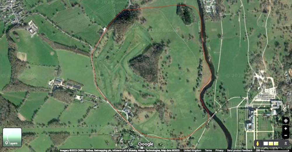
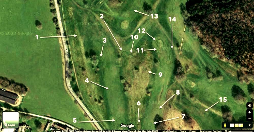
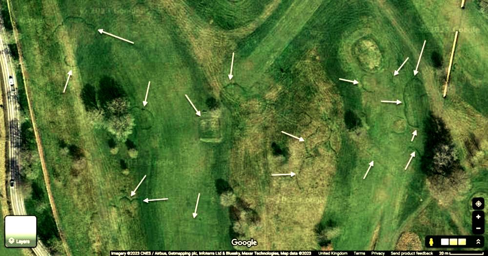
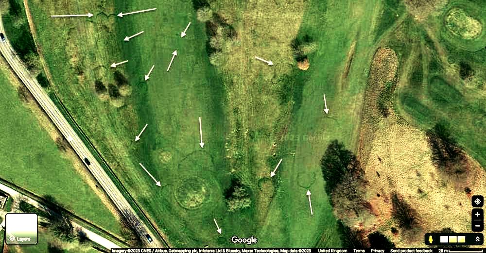
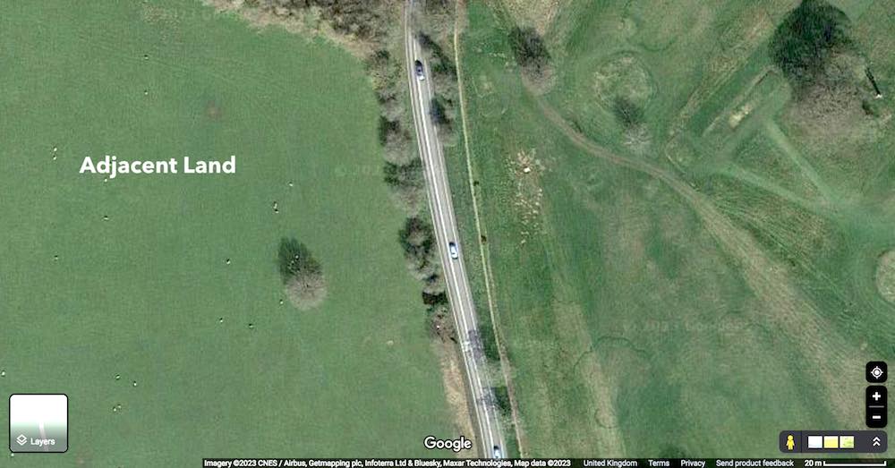
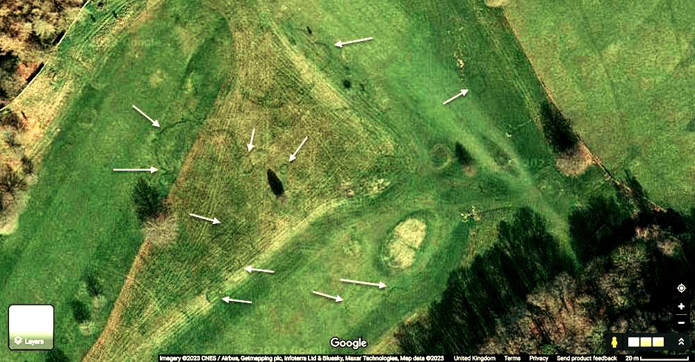
Our second aerial area of archaeological interest is area 2, also in Bakewell, the image below is the area in question. Aerial Archaeology of The Peak District - Bakewell 2In partnership with The Corrigan Social FundSatellite & Geomapping StudyBAKEWELL 22023 1. Introduction to Area 2Our second aerial area of archaeological interest is area 2, also in Bakewell, and the image above is the area in question. This area is located only a few miles from area 1. There is a lot going on in PLATE 1, area 2 is right in the middle of PLATE 1. Area 2 is currently a golf course. The only reason we can see the structures in question here is because the grass has been cut short. All the proceeding plates have been processed so that depressions and high ground are more prominent. PLATE 2 shows area 2 in more detail. From this image we can see that there is an old processional trackway leading past the bottom of area 2. Area 2 is marked by the red boundary line that encircles the it. We can see from this image that the boundaries in the surrounding fields do not impinge on area 2. This demonstrates that area 2 has been isolated at some point in the past from the surrounding agricultural activities. This is why it has not been destroyed by ploughing. As we zoom in more on Google Maps we can start to see shapes appearing out of the grass. Once again, this was taken during a dry period in the UK. As can be seen, there are at least 15 separate structures in the next image, PLATE 3, they will become clearer as we zoom in more. Many of these structures are nothing more than depressions, which show up as darker patches where ditches have been dug to house retaining walls. In PLATE 4 and subsequent plates we have refrained from numbering the arrows as they obscure smaller structures. The 2 white arrows at the top left of PLATE 4 however, mark the interesting 'lobed' structure numberered as arrow 1 in PLATE 3. At this zoom level, we can now start to make out distinct shapes in the short grass. Many of these shapes are round and are similar to the shapes seen in area 1, go HERE to read about area 1, also in Bakewell. PLATE 5 is the grassy area located directly below PLATE 4 and it overlaps it. Here we can see even more of the markings, again, many of them appear circular. Some of them are bunched up together, some are not, many have irregular circle shapes. Similar shapes have been made by the landscapers however, so caution should be made in the interpretation of these structures. All the structures pointed out here are based on obvious depressions and older ditches. PLATE 6 has been included so that a comparison with adjacent agricultural land can be made. It can clearly be seen that the field on the left has been ploughed out and currently has sheep grazing upon it. The field to the left is smooth and consistent in its colour meaning there are few depressions or raised areas. Area 2 to the right by contrast is very different. It has lumps and bumps, structures, stripes and a mottled appearence. PLATE 7 shows a more densely populated part of area 2. In the middle of the image we can see many circular structures and some 'lobed' shapes too. Some of these circular shapes are again, bunched up together, as if they were closely associated with one another. Are these round houses or other dwellings of some kind? Leave your thoughts and comments below, we would love to know what you think. This area is close to area 1, is it connected? Until the next time! PLEASE NOTE: These images have been compressed so that Google does not penalise this article. This destroys some of the detail, sorry about this. Here are downloadable non-compressed images that show good detail of some of these structures. 2. The Images
0 Comments
Your comment will be posted after it is approved.
Leave a Reply. |
|||||||||||||||||||||||||||||||||||||||||||||||||||||||
Peak Soap
The Original Bakewell Soap Co.
Contact : [email protected] | Copyright 2023 © P e a k S o a p Ltd.
P e a k S o a p™ Ltd. is registered in the United Kingdom | Office : Diamond House, Water Street, Bakewell, DE45 1EW | Company No. 11684582
P e a k S o a p™ Ltd. is registered in the United Kingdom | Office : Diamond House, Water Street, Bakewell, DE45 1EW | Company No. 11684582

